How Nepal Measured Mount Everest’s Height: The Story Behind 8,848.86 Meters
Mount Everest has long represented Nepal’s natural heritage, national identity, and extraordinary Himalayan landscape. Standing at the highest elevation on Earth, the mountain has also been the subject of scientific measurement for decades.
But after the 2015 Nepal earthquake, an important question emerged: Had the earthquake changed the height of Mount Everest?
To answer that question scientifically, Nepal undertook one of its most significant geodetic surveying projects. The Government of Nepal decided to conduct a new Mount Everest height measurement using its own survey experts, modern satellite technology, and high-precision geodetic techniques.
The result was announced in 2020: Mount Everest's official height is 8,848.86 meters (29,031.69 feet).
But reaching that number involved much more than simply measuring the mountain from its base to its summit.
Why Did Nepal Measure Mount Everest Again?
The height of Mount Everest had already been measured several times before Nepal conducted its own survey. However, the 2015 Gorkha earthquake created new scientific questions about the elevation and physical structure of the Himalayan region.
The earthquake was a major tectonic event, raising questions about whether movement of the Earth's crust had affected Mount Everest.
Scientists and surveyors therefore needed reliable measurements to determine whether there had been any significant change.
For Nepal, the project also had another important purpose.
It provided an opportunity for Nepali survey professionals to demonstrate their ability to conduct a complex high-altitude geodetic survey using modern technology and internationally recognized surveying methods.
Nepal’s Independent Mount Everest Measurement
One of the most significant aspects of the project was Nepal's decision to lead the measurement through its own surveying institutions and technical experts.
The Department of Survey, Nepal coordinated the project and deployed Nepali surveyors to collect measurements from different locations around the mountain.
The project involved a combination of technologies and surveying techniques, including:
- Global Navigation Satellite System (GNSS)
- GPS technology
- Precise leveling
- Gravity measurements
- Trigonometric surveying
- Geodetic observations
- Satellite-based positioning
Using multiple methods was important because determining the elevation of a mountain as large and complex as Everest requires more than one measurement technique.
Why Use Multiple Surveying Techniques?
Every surveying technology has its own strengths and limitations.
GNSS can determine precise coordinates using signals from navigation satellites, while leveling can help establish elevation differences between points. Gravity measurements can also provide important information for geodetic calculations.
By combining these measurements, surveyors can build a more reliable elevation model.
This approach is particularly important in mountainous environments where terrain, atmospheric conditions, snow, ice, and extreme weather can make conventional surveying difficult.
The Everest Survey Team Reached the Summit
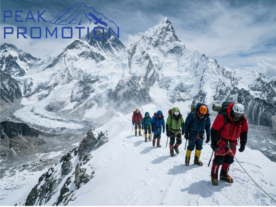
A crucial stage of Nepal's Everest remeasurement project took place in 2019, when a team of Nepali surveyors reached the summit.
Reaching the summit was not simply a mountaineering achievement. The surveyors had to carry specialized equipment and conduct measurements in one of the most challenging working environments on Earth.
At an altitude of almost 9,000 meters, survey operations are affected by:
- Extremely low temperatures
- Thin air and low oxygen levels
- Strong winds
- Unpredictable weather
- Snow and ice
- Difficult terrain
- Limited working time at high altitude
The successful summit measurement demonstrated the ability of Nepali technical teams to conduct sophisticated scientific operations under extreme conditions.
How Was Mount Everest’s Height Actually Measured?
Measuring the height of Everest is more complicated than simply placing a measuring instrument at the bottom of the mountain and another at the summit.
The 8,848.86-meter elevation represents the mountain's elevation relative to a defined vertical reference system, commonly described in terms of mean sea level.
Surveyors therefore needed to establish reliable reference points and connect measurements from lower elevations to the summit.
1. Establishing Survey Control Points
Surveyors first worked with a network of accurately positioned control points.
These points provide known geographic coordinates and elevations that can be used as references for further measurements.
A strong control network is essential for large-scale geodetic projects because measurements taken at different locations need to be connected to a consistent reference system.
2. Using GNSS and GPS
GNSS technology played an important role in the Everest measurement.
GNSS receivers communicate with navigation satellites to determine highly precise geographic positions.
At the summit, specialized equipment was used to obtain satellite-based measurements.
These observations could then be combined with measurements from other survey locations to calculate the summit's position and elevation.
3. Precise Leveling
Precise leveling is a traditional but highly accurate surveying technique used to determine differences in elevation between points.
For a project such as Everest's measurement, leveling helps connect elevation information from established reference locations toward higher elevations.
Although modern satellite technology has transformed surveying, traditional geodetic techniques remain important when establishing accurate vertical references.
4. Gravity Measurements
Gravity also matters when determining accurate elevations.
The Earth's gravitational field is not perfectly uniform. Differences in gravity can affect geodetic calculations and the relationship between physical measurements and elevation.
Gravity observations therefore provide additional information that can improve the accuracy of a geodetic survey.
5. Trigonometric Surveying
Trigonometric surveying uses measured angles and distances to calculate the positions and elevations of points.
Surveyors can observe distant locations using instruments and mathematical relationships to determine elevation differences.
Combining this method with satellite observations and other geodetic measurements provides another layer of verification.
What Is the Official Height of Mount Everest?
After collecting and analyzing the survey data, Nepal and China jointly announced the new official height of Mount Everest on December 8, 2020.
The officially announced elevation is:
8,848.86 meters
29,031.69 feet
This measurement is 0.86 meters higher than the previously recognized elevation of 8,848 meters.
The new figure was subsequently adopted by both Nepal and China as the official height of Mount Everest.
Mount Everest Height: Old vs. New Measurement
| Measurement | Height |
| Previously recognized height | 8,848.00 m |
| New official height | 8,848.86 m |
| Difference | 0.86 m |
| New height in feet | 29,031.69 ft |
| Official announcement | December 8, 2020 |
The difference may appear small, but even a change of less than one meter is scientifically significant when determining the official elevation of the world's highest mountain.
Did the 2015 Earthquake Change Mount Everest’s Height?
This was one of the central questions behind the remeasurement project.
The 2015 earthquake in Nepal generated significant tectonic movement across the region. Because Mount Everest is located within the active Himalayan mountain-building system, scientists had reason to examine whether the earthquake had affected its elevation.
However, determining the effect of an earthquake on mountain elevation requires precise measurements before and after the event and careful geodetic analysis.
The Everest remeasurement therefore provided updated data that helped address the uncertainty surrounding the mountain's elevation.
It is important to understand that the new 8,848.86-meter figure should not simply be interpreted as "the earthquake made Everest 0.86 meters taller." The difference from the earlier 8,848-meter figure also reflects improved surveying techniques, reference systems, and measurement methodology.
Why Was Nepal’s Everest Survey Historically Important?
The project represented more than an update to a number in geography textbooks.
It demonstrated Nepal's growing capabilities in geospatial technology, surveying, and geodesy.
For decades, measurements of Mount Everest had involved international scientific and surveying organizations. Nepal's decision to conduct its own measurement demonstrated increasing technical self-reliance.
The project highlighted several important areas of national capability.
✔ Scientific Capability
Nepali survey professionals successfully worked with advanced positioning and geodetic technologies to undertake an internationally significant scientific project.
✔ Technical Expertise
The survey required knowledge of satellite positioning, geodesy, precise measurement, data processing, and high-altitude field operations.
✔ National Self-Reliance
Conducting such a demanding survey under Nepali leadership represented an important step toward greater technical independence in geospatial measurement.
✔ International Cooperation
Although Nepal led the measurement, the final determination also involved collaboration with China.
This combination of national expertise and international cooperation helped establish the officially recognized measurement.
The Role of Geospatial Technology in Measuring Everest
The Everest project is also an excellent example of how geospatial technology can solve complex real-world problems.
Modern surveying is no longer limited to traditional instruments. It combines satellite positioning, geographic information systems, remote sensing, digital mapping, geodesy, and sophisticated data processing.
For a mountain such as Everest, these technologies can help surveyors:
- Determine precise coordinates
- Measure elevation
- Establish geographic reference networks
- Monitor terrain changes
- Analyze tectonic movement
- Create detailed topographic maps
- Support disaster-risk assessment
- Improve geographic information systems
The same technologies used in major geodetic projects can also support urban planning, infrastructure development, disaster management, environmental monitoring, transportation planning, and location intelligence.
Why Accurate Mountain Measurements Matter?
Knowing the exact height of Mount Everest may seem like a purely geographical exercise, but accurate elevation data has broader scientific importance.
✔ Geodesy and Earth Science
Precise measurements help scientists understand changes in the Earth's surface and the movement of tectonic plates.
✔ Climate and Environmental Research
Accurate geographic and elevation information can contribute to studies involving glaciers, snow cover, climate change, and Himalayan ecosystems.
✔ Disaster Management
Geospatial data can help researchers and authorities understand terrain and identify areas exposed to hazards such as landslides, earthquakes, and avalanches.
✔ Mapping and Navigation
Reliable elevation data contributes to improved topographic maps and geographic databases.
✔ Mountain Tourism
Mount Everest is one of Nepal's most important tourism assets. Accurate geographic information supports expedition planning, mapping, and mountain operations.
Everest Measurement and Nepal’s Mountain Tourism
Mount Everest is not only a scientific landmark. It is also at the center of Nepal's international mountaineering industry.
Every year, climbers, researchers, expedition teams, photographers, and visitors from around the world travel to the Himalayan region.
A successful Everest expedition requires extensive preparation and logistical coordination.
This includes:
- Route planning
- Equipment transportation
- High-altitude logistics
- Expedition support
- Sherpa and mountain staff coordination
- Communication
- Safety planning
- Accommodation and transportation
- Environmental considerations
The Everest height measurement project similarly required specialized logistical support because scientific equipment and personnel had to operate in an extremely demanding environment.
Supporting the Historic Everest Survey
During the historic survey mission, Peak Promotion Pvt. Ltd. provided support related to expedition logistics, mountain operations, and transportation of essential equipment for the survey team.
With experience in Himalayan expedition operations, companies involved in mountain logistics play an important role in helping teams operate safely and efficiently in remote and high-altitude environments.
The Everest survey therefore brought together several different areas of expertise—from geodesy and satellite technology to expedition logistics and mountain operations.
Mount Everest: Where Science Meets the Himalayas
The measurement of Mount Everest demonstrates how modern science can be applied in one of the world's most challenging environments.
At first glance, determining the height of a mountain may seem straightforward. In reality, establishing an official elevation requires precise reference systems, satellite observations, field measurements, mathematical calculations, and data verification.
Nepal's Everest measurement project showed that the country has the technical expertise and institutional capability to undertake sophisticated geospatial projects of global significance.
The final figure—8,848.86 meters—is therefore more than a number.
It represents a combination of scientific measurement, technological advancement, national expertise, international cooperation, and the enduring significance of Mount Everest to Nepal.
Key Facts About Mount Everest’s Measurement
| Fact | Details |
| Mountain | Mount Everest |
| Official height | 8,848.86 meters |
| Height in feet | 29,031.69 feet |
| Previous recognized height | 8,848 meters |
| Difference | 0.86 meters |
| Earthquake prompting renewed interest | 2015 Nepal earthquake |
| Nepal's summit measurement | 2019 |
| Official announcement | December 8, 2020 |
| Lead institution in Nepal | Department of Survey |
| Key technologies | GNSS, GPS, precise leveling, gravity and trigonometric surveying |
Frequently Asked Questions (FAQ's):
Q: What is the official height of Mount Everest?
Mount Everest's official height is 8,848.86 meters (29,031.69 feet). Nepal and China jointly announced this measurement on December 8, 2020.
Q: Why did Nepal remeasure Mount Everest?
Nepal initiated the remeasurement following questions about whether the 2015 earthquake had affected Everest's elevation. The project also allowed Nepal to conduct a modern measurement using its own survey expertise and technology.
Q: How did Nepal measure Mount Everest?
Nepal used a combination of GNSS/GPS, precise leveling, gravity measurements, and trigonometric surveying, along with observations collected from the summit and other survey locations.
Q: When did Nepal's surveyors reach the Everest summit?
A team of Nepali surveyors reached the summit in 2019 to conduct field measurements as part of the Everest remeasurement project.
Q: Who conducted the Everest measurement in Nepal?
The Department of Survey, Nepal, coordinated Nepal's measurement project using Nepali survey professionals and modern geodetic techniques.
Q: Did the 2015 earthquake change Mount Everest's height?
The earthquake prompted renewed scientific investigation into Everest's elevation. However, the difference between the old and new official measurements cannot simply be attributed to the earthquake because improvements in surveying technology, geodetic methods, and reference systems also contribute to differences between measurements.
Q: How much higher is the new Everest measurement?
The new official elevation of 8,848.86 meters is 0.86 meters higher than the previously recognized 8,848-meter measurement.
Q: Is Mount Everest still the highest mountain in the world?
Yes. At 8,848.86 meters above sea level, Mount Everest remains the highest mountain above sea level on Earth.
Q: What technology was used to measure Everest?
The survey incorporated technologies and methods including GNSS, GPS, precise leveling, gravity observations, and trigonometric surveying.
Q: Why is accurate Everest measurement important?
Accurate elevation data contributes to geodesy, Earth science, mapping, environmental research, disaster management, and mountain studies.
Q: When was the new Everest height announced?
Nepal and China officially announced the new height on December 8, 2020.
Q: What role does surveying technology play in Nepal?
Modern surveying and geospatial technologies support many areas, including urban planning, infrastructure development, land management, disaster response, environmental monitoring, and geographic information systems.
Conclusion: A Scientific Milestone for Nepal
The story of how Nepal measured Mount Everest's height is ultimately a story about much more than determining a number.
The Everest remeasurement demonstrated Nepal's ability to combine modern geospatial technology, scientific expertise, field surveying, and high-altitude operations to undertake a project of international significance.
After extensive fieldwork and data analysis, Nepal and China officially established Mount Everest's height at 8,848.86 meters (29,031.69 feet) in December 2020.
For Nepal, the project represented an important milestone in scientific and technical capability. For the global scientific community, it provided a modern and officially recognized measurement of the world's highest mountain.
And for everyone connected to the Himalayas, the result added another chapter to the remarkable story of Mount Everest and Nepal.
From accurate surveying to complex mountain expeditions, Nepal continues to demonstrate how technology, expertise, and Himalayan experience can work together to accomplish extraordinary projects.
During this historic survey mission, Peak Promotion Pvt. Ltd. provided valuable support in expedition logistics, mountain operations, and transportation of essential equipment for the survey team. With decades of experience organizing expeditions across Mount Everest and other Himalayan peaks, Peak Promotion continues to deliver safe, professional, and reliable mountaineering services while contributing to the sustainable development of Nepal's mountain tourism.